
| Area | 3,287,263 Km2 |
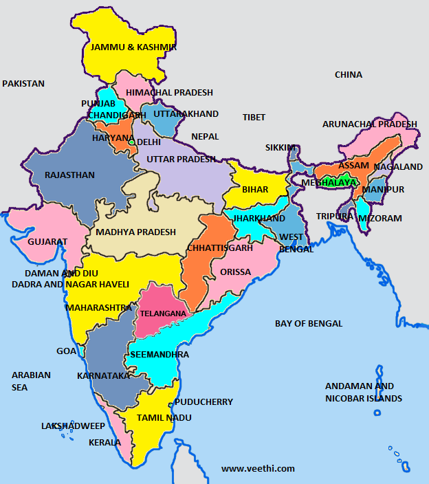
| States | 29 |
| Union Territories | 7 |
| Districts | 718 |
| Population | 1,358,193,462 |
| Urban population: | 45.09 (in crore) |
| Rural population: | 90.7 (in crore) |
| Life Expectancy | 69.09 yrs |
| Birth rate | 19 births/1,000 population |
| Death rate | 7.3 deaths/1,000 population |
| Religion in India | |
|---|---|
| Hindus | 80% |
| Muslims | 13% |
| Christians | 2.30% |
| Sikhs | 1.9% |
| Jains | 0.4% |
| Buddhists | 0.8% |
| Indian Statistics | ||
|---|---|---|
| Population Ratio | 936 females per 1000 males | More Info... |
| Density of population | 415.6 persons per sq. km | More Info... |
| Most populous state | Uttar Pradesh : 166,197,921* | Uttar Pradesh |
| Area with Highest Literacy | Kerala : 93.91% | More Info... |
| Largest State | Rajasthan : 342,236 km2 | Rajastan |
| Largest City | Mumbai | More Info... |
| Offical Languages | Hindi and English | More Info... |
| Lok Sabha | 545 (543 elected + 2 appointed) | More Info... |
| Rajya Sabha | 245 (233 elected + 12 nominated) | More Info... |
| State with Most Parliamentary Constituencies | Uttar Pradesh : 80 | Uttar Pradesh |
| Currency | Indian Rupee (INR) | |
| Union Territories of India | ||
|---|---|---|
| Andaman & Nicobar Islands | Chandigarh | Dadra & Nagar Haveli |
| Daman & Diu | Delhi | Lakshadweep |
| Pondicherry | ||
| Indian Languages | ||
|---|---|---|
| Hindi | Assamese | Bengali |
| Gujarati | Kannada | Malayalam |
| Marati | Punjabi | Tamil |
| Telugu | Sanskrit | Oriya |
| Konkani | Sindhi | Tulu |
| Urdu | ||

NRIOL.COM, the premier online community since 1997 for the Indian immigrant community provides a range of resourceful services for immigrants and visitors in America.
Estd. 1997 © Copyright NRI Online Pvt. Ltd. All rights reserved worldwide.


